
EV Navigation and Route Planning
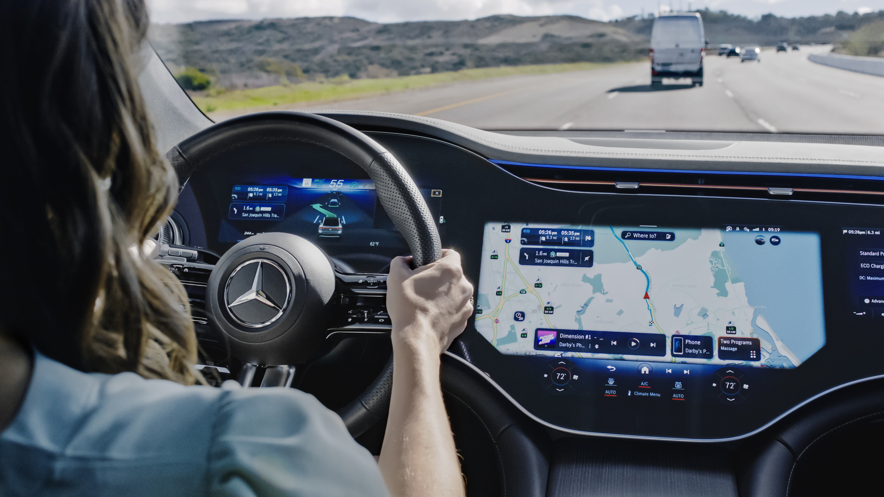
EV navigation must answer two questions at once: how to reach the destination and where the vehicle can charge without wasting time or running short of energy. The quality of that answer depends on vehicle data, charger data and how quickly the plan adapts.
Position, maps and routing
Satellite navigation provides position and precise time. GPS is one satellite constellation; a vehicle may support other global navigation satellite systems as well. The receiver calculates its position from transmitted satellite signals, while map software matches that position to a road network. GPS.gov: GPS overview
Tunnels, parking structures, tall buildings and terrain can block or reflect satellite signals. Vehicles can supplement them with wheel-speed, steering and motion data, but capability varies. Online traffic, road closures and charger status need a data connection unless the information has already been cached.
A useful system keeps enough map and route data in the vehicle to continue basic guidance through a temporary loss of coverage. Online services should improve the plan rather than make ordinary navigation collapse when the connection disappears.
How an EV route planner estimates the trip
An EV route planner starts with an energy model. Depending on the implementation and available data, it may consider:
- current state of charge and the usable energy estimate;
- recent or predicted consumption;
- speed, traffic and elevation;
- ambient temperature, wind and precipitation;
- cabin heating or cooling;
- battery temperature;
- payload or a trailer setting;
- charger connector, power and access; and
- the vehicle’s charging curve at the expected arrival state of charge.
The result is an estimate, not a reserve of energy. Weather, detours, driving speed and an unavailable charger can change it after departure. The most informative systems show the predicted state of charge at the destination and each charging stop, then update it continuously instead of displaying only distance.
Google Maps built into compatible EVs can display estimated battery level on arrival, add charging stops automatically and estimate a minimum charging time from the expected arrival charge, vehicle capability and station speed. Feature availability depends on the manufacturer, region and data plan. Google Maps Help: EV features built into a vehicle
Selecting charging stops
The shortest charging stop is not always at the charger with the largest advertised number. A route planner should account for the vehicle’s connector and maximum power, the battery’s expected charge level and temperature, and how charging power tapers as the battery fills.
It should also distinguish power from reliability. Live availability can help, but a status feed may be delayed or incomplete. Access hours, payment requirements, queues, trailers, charging-network restrictions and broken stalls can matter more than a small difference in rated power.
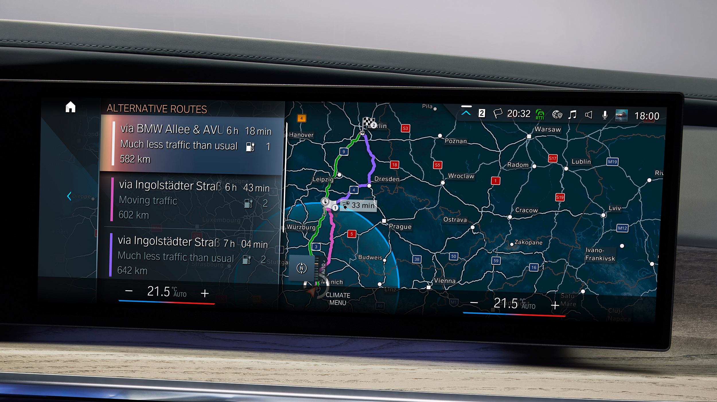
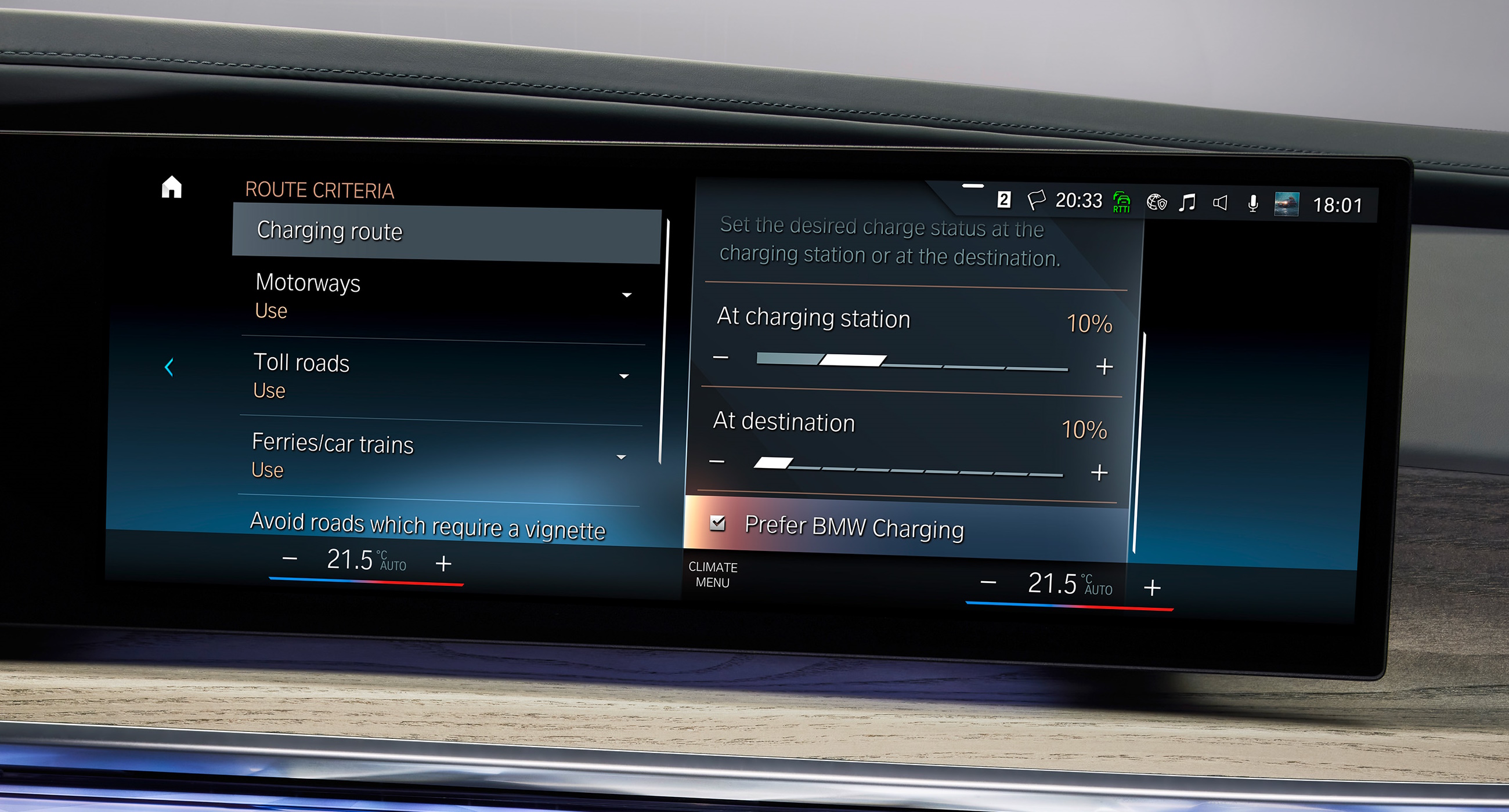
Good systems let the driver inspect and replace a proposed stop, set an arrival reserve and choose priorities such as fewer stops, shorter total time or preferred networks. Some calculate only with one charging network; others include third-party sites but have less complete status data. These differences are more consequential than minor variations in map graphics.
Battery preconditioning
Fast charging is sensitive to battery temperature. In vehicles that support navigation-linked preconditioning, selecting a recognized fast charger as the destination can tell the thermal-management system to prepare the battery before arrival. Tesla’s current Model Y manual, for example, states that Trip Planner may preheat the battery while navigating to a Supercharger or, in some regions, a supported third-party fast charger. Tesla Model Y Owner’s Manual: Maps and Navigation
This function is vehicle-specific. Searching for a charger on a phone, dropping a generic map pin or navigating with an unsupported app may not trigger it. A driver should check the owner’s manual and the car’s on-screen indication rather than assume that any route to a charger prepares the battery.
EVKX explains the underlying systems in Charging and Battery Thermal Management.
Built-in navigation and phone apps
Built-in navigation has the best opportunity to use live state of charge, consumption and battery-temperature data. Phone projection is not necessarily blind to the vehicle, however. Apple Maps can provide EV routing with charge monitoring and compatible-station selection for supported vehicles and regions, either through CarPlay or a manufacturer app. Apple Support: Set up electric-vehicle routing in Maps
The practical distinction is the depth of integration in the exact model:
- Can the route planner read the real state of charge?
- Does it know the vehicle’s connector and charging curve?
- Can it trigger battery preconditioning?
- Does it show expected arrival charge in the driver display or head-up display?
- Can a route planned on a phone be sent to the car without losing its charging plan?
- Which functions remain after the connected-services trial ends?
An independent phone app can still be valuable for checking alternative networks or planning a trip before entering the vehicle. On a difficult route, comparing two planners can expose optimistic consumption or missing chargers before departure.
Failure planning
Do not treat a planned charging stop as guaranteed access. Before a long or remote trip, verify the site in the charging network’s own service, inspect recent status where available and identify an alternative before the energy reserve becomes small.
Keep the arrival reserve larger in cold weather, strong wind, heavy rain, mountain driving or while towing. If the predicted destination charge falls steadily, reduce speed or select an earlier charger while choices remain. The route planner is most useful as a continuously updated decision aid, not as a fixed itinerary.
What to test before buying
Plan a route longer than the vehicle’s indicated range and inspect every proposed stop. Change the destination mid-route, remove a charger and look for alternatives. Check whether the system shows arrival charge, charging duration, live availability, price or access restrictions without hiding the assumptions.
Then test offline behavior, voice destination entry, map updates and route transfer from the manufacturer’s app. A navigation system earns trust by explaining a changing energy plan clearly, not by producing the most optimistic arrival number.